Home
World
NEW
Premium
Winkel
tochten
Artikels
Help - ondersteuning
Français
English
Nederlands
Español
Italiano
Deutsch
Aansluiting
Home
World
Premium
Winkel
tochten
Artikels
Help - ondersteuning
SityTrail
>
POI's
>
GCN4EW
SityTrail
>
POI's
>
GCN4EW
GCN4EW
Beschrijving
Long slope by norpan, back, an
Foto's
Ontdek GCN4EW met de volgende tochten...
tracegps
Sentiers des Pointières
Stappen
Medium
Queige, Auvergne-Rhône-Alpes, Savoie, France
6,8 km | 11,3 km-effort
3h 30min
Ja
tracegps
Gebruiker
©
OpenStreetMap
contributors
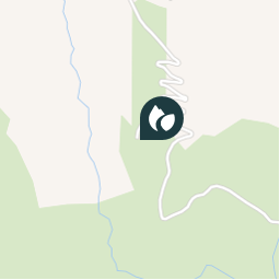
Plaatsbepaling
Land:
France
Regio :
Auvergne-Rhône-Alpes
Departement/Provincie :
Isère
Gemeente :
Le Freney-d'Oisans
Locatie:
Unknown
Plaatsbepaling
45.090967 / 6.126867
Datum van aanmaak :
2018-04-09 12:17:33.421
Laatste wijziging
2018-04-09 12:17:33.421
(0 Bericht)
Opmerkingen
Gelieve in te loggen om een commentaar of een beoordeling achter te laten
POI's in de buurt
tracegps
GCN4EW
LE FRENEY-D'OISANS
tracegps
GCN4EW
LE FRENEY-D'OISANS
tracegps
GCN4EW
LE FRENEY-D'OISANS
tracegps
GCN4EW
LE FRENEY-D'OISANS
tracegps
GCN4EW
LE FRENEY-D'OISANS
JCottard
Quitter à droite
LE FRENEY-D'OISANS
fel
Point 2
HUEZ
tracegps
GCN194
HUEZ
Sluiten
Mijn abonnementen